netdiff.py#
This script compares two .net.xml files. The call
python tools/net/netdiff.py A.net.xml B.net.xml diff
will produce 4 plain-XML network files:
- diff.nod.xml
- diff.edg.xml
- diff.con.xml
- diff.tll.xml
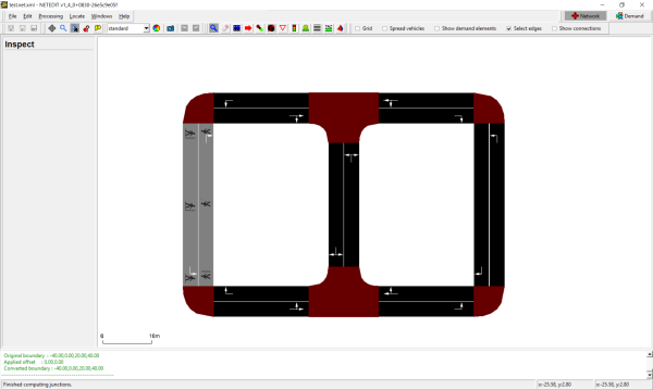
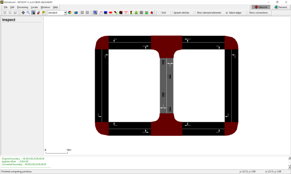
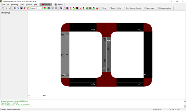
These files contain groups of xml elements (i.e. nodes) that have been deleted, created, or modified and can be used to investigate differences between the two networks A and B. Furthermore, these files can be used to maintain change-sets for making repeatable modifications:
netconvert --sumo-net-file A.net.xml -n diff.nod.xml -e diff.edg.xml -x diff.con.xml -i diff.tll.xml -o B.net.xml
The above call can be used to recreate network B based on A and the recorded change-set. Note, that for any modified elements (i.e. modified speed limit for an edge), the file diff.edg.xml only contains to modified attributes.
A typical use case for netdiff.py is this:
- Import a network from OSM (call this A.net.xml)
- Make some modifications with netedit (save this under the new name B.net.xml)
- Use
netdiff.pyto create the diff-files - At a later date, re-import the OSM network (with a newer OSM file, a new version of netconvert or different options)
- Re-apply the diff-files to avoid repeating manual corrections with netedit


patching on import#
If the patch file is to be applied during the initial network import (e.g. from OSM), the netdiff option -i must be set. Due to the way connections are guessed during network import, all connections for an edge must be included in the patch file if any of them were changed. This is accomplished by setting -i (--patch-on-import).
patching a network different from the original#
Sometimes it may be useful to apply the difference between networks A and B to another network C than differs slightly from A. In this case it may be useful to only consider some of the changes (i.e. only created elements).
If only the newly created elements in B (relative to A) shall be considered, open each of the difference files (ie. diff.edg.xml, diff.nod.xml, diff.con.xml, diff.tll.xml) and keep only the elements below the heading
<!-- Created Elements -->"
This way the patch should be applicable to network C regardless of how it differs from the original A.
Sometimes, errors may occur due to inconsistent connections or traffic lights. In this case, it may be useful to only update C with 'diff.nod.xml and 'diff.edg.xml' and let netconvert guess the respective connections and traffic lights.
In the end all regions where the area of C and B borders each other should be checked manually for consistency.
createRoundaboutConnections.py#
This script generates additional connections for roundabouts from a given network. The following connections are added:
- vehicles can stay inside of the roundabout on every lane.
- vehicles can leave a roundabout even if they are driving on an inner lane if there are enough outgoing lanes.
Usage:
python tools/net/createRoundaboutConnections.py <net-file>
This creates the output file roundabout-connection.con.xml, where the input network is <net-file>.
netcheck.py#
This tool checks the network (first parameter) for weak connectivity (whether there is a route from every node to every other node, regardless of edge direction) and prints the connected components if not.
Additionally, you may run this script to discover which edges are reachable from a particular edge.
python tools/net/netcheck.py <net-file> --source <edge_id> --selection-output selection.txt
This will create a file called selection.txt which can be loaded in
sumo-gui to visualize the portion of the network
reachable from <edge_id>. To visualize the selection, you must load the
file via Edit->Edit chosen. Then, you need to enable
edge coloring by selection status in the view settings dialog
Street->Color by: selection. The reachable portion of the network
will be colored differently from the unreachable portion which is
usually sufficient to figure out network modeling errors.
The options can be shortened to -s <edge_id> for source edges and -o <filename> for selection output.
Using option --destination <edge_id>, or -d <edge_id>, lists edges which can reach the given edge. By adding the option --vclass <vClass>, or -l <vClass>, the check becomes vClass-aware.
The option --component-output <filename>, or -c <filename>, writes all the identified components and their constituent edges to the specified file. The option --results-output <filename>, or -r <filename>, writes the whole network summary of largest component percentage coverage and component edge count distribution to the specified file.
The --component-output and --results-output options are not compatible with the --destination or --source options.
Use the option --help for the latest version information.
xmledges_applyOffset.py and xmlnodes_applyOffset.py#
Both tools apply the given offset to the geometrical information of edges or nodes given in the input file. The results are written into <XMLEDGES>.mod.xml or <XMLNODES>.mod.xml, respectively.
python tools/net/xmledges_applyOffset.py <XMLEDGES-FILE> <X-OFFSET> <Y-OFFSET>
python tools/net/xmlnodes_applyOffset.py <XMLNODES-FILE> <X-OFFSET> <Y-OFFSET>
- <XMLEDGES-FILE>/<XMLNODES-FILE>: The edges/nodes file whose content shall be shifted
- <X-OFFSET>: The x-offset to apply
- <Y-OFFSET>: The y-offset to apply
xmlconnections_mapEdges.py#
Reads edge id replacements from "edgemap.txt"; the format of this file is:
<OLD_EDGE_ID>-><NEW_EDGE_ID>
Reads the given connections file <CONNECTIONS-FILE> and replaces old edge names by the new ones. The result is written to <CONNECTIONS-FILE>.mod.xml
python tools/net/xmlconnections_mapEdges.py <CONNECTIONS-FILE>
- <OLD_EDGE_ID>: Id of an edge as used within <CONNECTIONS-FILE>
- <NEW_EDGE_ID>: Id of the edge to use instead
- <CONNECTIONS-FILE>: The connections file to change
net2kml.py#
converts '.net.xml' road geometries to KML format.
python tools/net/net2kml.py -n <net-file> -o output.kml
By default, normal edge geometries will be exported. This can be changed with options
- --lanes: write lane geometries
- --internal: write junction-internal edges or lanes
- --junctions: export junction geometries
- --boundary: write edge/lane boundaries instead of center-lines
- --traffic-lights write coordinates for the colored signals
net2geojson.py#
converts '.net.xml' road geometries to GeoJSON format.
python tools/net/net2geojson.py -n <net-file> -o output.geojson
By default, normal edge geometries will be exported. This can be changed with options
- --lanes: write lane geometries
- --internal: write junction-internal edges or lanes
It is also possible to enrich the generated geojson with edge-related data (i.e. traffic counts or speeds) by loading an edgedata file with option --edgedata-file.
split_at_stops.py#
Generates an .edg.xml patch file with split definitions to ensure that each public transport stop of the given type (default <trainStop>) is on a separate edge from every other stop. The tool also generates an updated .net.xml and stop file. Furthermore, it can adapt a route-file so it matches the updated network.
Example call:
python tools/net/split_at_stops.py <stopfile> -n <net-file> -r <route-file> -o <output-net-file> --stop-output <output-stop-file> --route-output <output-route-file> --stop-type busStop
Note
A similar functionality is achieved by stationDistricts.py --split-output FILE which splits edges at the midpoint between stops.
abstractRail.py#
Converts a geodetical rail network into an abstract (schematic) rail network. If the network is segmented (with stationDistricts.py), the resulting network will be a hybrid of multiple schematic pieces being oriented in a roughly geodetical manner
Example call:
python tools/net/abstractRail.py -n input_net.net.xml --stop-file input_additional.add.xml --region-file stations.taz.xml --output-prefix abstract
It is also possible to automatically segment the network:
python tools/net/abstractRail.py -n input_net.net.xml --stop-file input_additional.add.xml --split --output-prefix abstract
Further options#
- --filter-regions: Only convert the given list of regions and delete everything else
- --keep-all: When filtering regions, keep all other regions at their old geometry. This may be used to build region-specific patch files than can the combined to patch larger parts of the network**
- --horizontal: The abstract network is aligned on the horizontal
- --track-offset: Define the offset between parallel tracks in m (default 20)
- --skip-building: Only create patch files but do not assemble the new network
- --skip: creates a region file (taz) from the stop-file, optionally splits network edges to ensure that each edge belongs to a single station
Caution
If the network is large and not segmented or if the individual station segments are large, the conversion process can take a long time. The option --skip-large INT can be used to selective skip large regions (measured by the number of optimization constraints, reported via --verbose output).
Caution
If option --spit is used, the original network may be split (with the new filename OLDNAME.split.net.xml) and the generated abstract network will have the same edges as the split net. The input stop-file will also be adapted for the split net (with the new filename OLDNAME.split.add.xml) but any traffic demand (route files) have to be adapted for the split network. This can be accomplished by calling duarouter -n net.split.net.xml.gz -a stops.split.add.xml -r old.rou.xml -o new.rou.xml --repair --ignore-errors --skip-new-routes --ptline-routing
remap_additionals.py#
Remap infrastructure from one network to another if the networks have similar geometry. The following differences between networks are acceptable:
- changed edge ids
- changed lane number and permissions
- changed splits and joins of edges
- small variations in geometry
In case of changed lanes, permissions are taken into account to select a suitable replacement lane.
Example call:
python tools/net/remap_additionals.py --orig-net input_net.net.xml --target-net input_net2.net.xml -a input_additional.add.xml -o out.add.xml
remap_renamed.py#
Remap infrastructure, vehicles, routes or a selection file from one network to another if the new network has an origId param on every lane that reflects the edge id of the original network. A supported use case is converting the origial network with option --numerical-ids and then transforming other scenario file so that it can be used with the new network.
Example calls:
python tools/net/remap_additionals.py -n input_net2.net.xml -r input_routes.rou.xml -o out.rou.xml
python tools/net/remap_additionals.py -n input_net2.net.xml -a input_additionals.add.xml -o out.add.xml
python tools/net/remap_additionals.py -n input_net2.net.xml -s input_selection.txt -o selection.txt
remap_network.py#
Compute correspondence between two networks with somewhat similar geometry (but different splits, joins, ids etc). The output is a csv-file with an 1-to-n mapping of original edge to zero or more target edges. For each target edge, the common length in m as well as the fraction of the target edge being covered by the original edge are listed. Output on the quality of the mapping is written to --success-output.
Example call:
python tools/net/remap_network.py --orig-net net.net.xml --target-net net2.net.xml -o out.csv --success-output success.txt
